Solutions

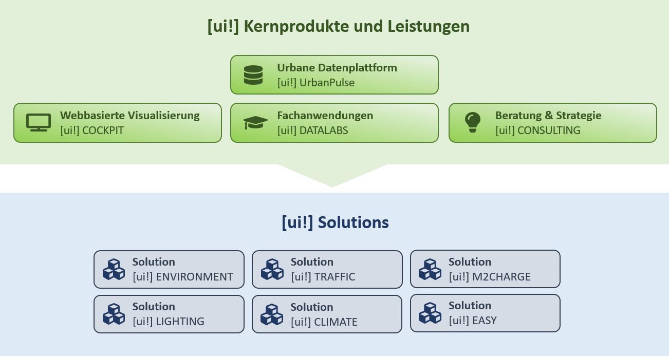
Our field-proven solutions are based on an open urban data platform
as the basis for numerous innovative services.

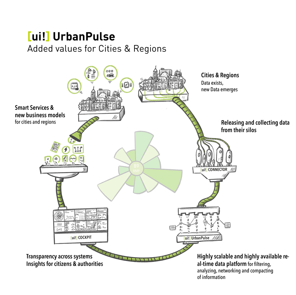
Based on [ui!] UrbanPulse, sensor and other real-time data from different data sources are collected and processed,
analysed and visualised as the "pulse of the city" in all relevant areas as beneficial data-based services.

[ui!] UrbanPulse
BASIC PLATFORM & VISUALIZATION OF URBAN DATA

[ui!] UrbanPulse

Open Urban Platform (OUP)

With [ui!] UrbanPulse, a real-time sensor data platform has been developed that follows the vision of an Open Urban Platform, as expressed by the European Innovation Partnership Smart Cities and Communities (EIP) and specified in DIN SPEC 91357.

[ui!] UrbanPulse is based on a highly scaleable architecture for data processing and analysis, with a special connector framework for an easy integration of sensors and other urban management systems.

On the basis of open interfaces, the platform offers integrated access to urban data from different urban areas.

City administrations, companies and citizens can use the data collected, refined with [ui!] UrbanPulse, to optimize their individual decisions and improve their digital services and processes.

Current connector overview
Below is a reference list with some of the connections already available in [ui!] UrbanPulse. Please note that some connectors require additional fees and third-party licenses:

1. Acoem Duo 01db (Noise sensors)
2. AEC ILLUMINAZIONE (Smart Lighting)
3. AGT (Video analytics pedestrian recognition)
4. Alperia E-Mobility (Charging data)
5. Alperia IoT Hub (cloud-to-cloud connector)
6. AQMesh (Air quality data)
7. Aquiba (Water Meter Systems)
8. Aruba (Smart WiFi Systems)
9. ATB Park & Display (Parking Ticketing Systems)
10. Australian Bureau of Meteorology (climate data)
11. Berliner Luftgütemessnetz (Environm. data)
12. BigBelly (Smart Trash bins)
13. Birtinya Parking (Smart Parking)
15. Brisbane Parking (Parking occupancy data)
16. Brisbane Traffic (Traffic detector data)
17. Brunata (Heating meter)
18. Cairns Smart Parking System
19. Cambio (Car sharing platform)
20. Chargecloud (Charging data)
21. ChargeIt (Charging data)
22. ChargePointOperator (OCPI Charging data)
23. Cisco Meraki (Smart WiFi Systems)
24. Civento (Construction Sites)
25. Clean City Networks (Waste bin data)
26. Cleverciti OffStreet (Parking Management)
27. Cleverciti OnStreet (Parking Management)
28. Cleverciti Ticks (Parking Management)
29. Cologne Parking (Parking garages data)
30. Cologne Traffic (Traffic flow data, Traffic Obstructions)
31. Comark Laser Scanner (Bike detection sensors)
32. Connctd IoT (Smart Home System)
33. Crossfleet (Car sharing platform)
34. CSV Data (generic data import)
35. Datex II (traffic data)
36. DB ParkSpace (Parking Data)
37. DB Flinkster (Car Sharing)
38. DB Call a Bike (Bike Sharing
39. DFKI onboard Unit (Car Telemetry Interface)
40. Discovergy (Smart Meter data)
41. Duo Smart Noise (Noise data)
42. Eco-counter (Traffic count data)
43. e-sensio urban SmartBox (Environmental Sensors)
44. Eluminocity (Charging data)
45. Emio (Environmental data)
46. EnBW Sm!ght (Smart lamp post, Environmental Sensing & EV Charger)
47. Enevo (Waste bin data)
48. Feratel (Event Calendar)
49. FHEM (Smart Home System)
50. FlareSense (Environmental data)
51. FlexDB (Energy data management system)
52. FLIR Flux (Traffic Camera Server System)
53. FLIR ITS (Traffic Cameras)
54. Floodmon (Flood Monitoring System)
55. GfS (Noise & weather station)
56. GoodMoovs (Car sharing platform)
57. Go Space Parking (Parking data)
58. GreenWay (Digital Signs)
59. Group Alarm (Alarm notification system for mission critical operations)
60. GTFS (Public transport data)
61. H2MParking (Temporary parking data collection)
62. HAMIS (Harbor information system)
63. Hawadawa (Environmental data)
64. HLNUG (Environmental data)
65. Homee (Smart Home data)
66. ICE Gateway (Environmental data)
67. INRIX (Parking data)
68. JSON Schema (generic data import)
69. KairosDB (Timeseries Database Connector)
70. Kerlink LoRa IoT Station (LoRaWAN Gateway)
71. Kimley Horn KITS (Traffic data)
72. KVB (Public transport station data)
73. LanUV (NRW environment data)
74. Las Vegas Traffic (Traffic detector & signal state data)
75. Libelium Plug&Sense Smart City (Sensor devices)
76. Libelium Plug&Sense Smart Environment (Sensor devices)
77. Libelium Plug&Sense Smart Environment Pro (Sensor devices)
78. LuenNi (Niedersachsen environment data)
79. manageE (per second energy meter)
80. Marine traffic (Ship monitoring system)
81. Modality (Container management system)
82. Modbus (Building Management System)
83. MOL BuBi (Hungarian bike sharing platform)
84. Mr. Fill (Smart Trash bins)
85. Netatmo (Environmental Sensors)
86. nextbike (Bike sharing platform)
87. Node Red (Data flow system)
88. NXP (RFID tag data)
89. NYC Traffic (Traffic detector & signal state data)
90. OCIT-C (Standard for Traffic Management Systems)
91. OCPI Last Mile Solutions (EV charging)
92. One M2M (cloud-to-cloud connector)
93. OpenWeatherMap (Weather data)
94. OWLET Nightshift (Luminaire status and energy consumption data)
95. OWLET IOT (Luminaire status and energy consumption data)
96. Philips City Touch (Smart Lighting)
97. Purple Air (Environmental Sensors)
98. Purple Wifi (Smart WiFi System)
99. RhineCloud (Parking data)
100. Reekoh (cloud-to-cloud connector)
101. RMV (Public Transport in Hessian, Germany)
102. RTB Verkehrstechnik (Traffic counting systems)
103. Ruckus (Smart WiFi System)
104. RUDIS (cloud-to-cloud connector)
105. Scheer (Energy management)
106. Screen scraper (Data extraction from websites)
107. SCC geoserver (spatial data)
108. SCC Solarfarm (PV and weather data)
109. Scoot (Adaptive Traffic Control Systems)
110. SensorThings (Open Geospatial Consortium-Standard)
111. Sentry (MQTT broker)
112. SIEMENS SENTRON (Energy Monitoring & Power Distribution)
113. SIEMENS (Traffic Management Systems)
114. Smart Link (Irrigation data)
115. Spot (Environmental Sensors)
116. SPP Analytics (Signal Phase Timings)
117. Sustainder Brokerage (Smart Lighting)
118. SWARCO KR (Traffic Management System)
119. SWARCO TMS (Traffic Management System)
120. Swisstraffic (Traffic detector data)
121. Translink (Public transport data)
122. Tüga Plusportal (Smart Wifi System)
123. TVILIGHT (Smart Lighting)
124. Vaisala (Environment – receives pushed data)
125. VDH (Traffic counting & video)
126. Vivacity Labs Tracks (Traffic management)
127. Vivacity Labs V2 (Traffic management)
128. Vivarium (Smart Zoo)
129. Viom Floating Car Data (FCD)
130. WaveScape (Crowd based sound measurement platform)
131. Wordpress (Newsfeed)
132. YellowMap (Charging stations in Germany)
133. Ymatron (Waste bin data)
134. Zenner ElementIoT (LoRaWAN network server)
135. Zeta (Charging controller)


Further connectors are currently under development...

[ui!] UrbanPulse
VISUALIZATION OF URBAN DATA

[ui!] COCKPIT

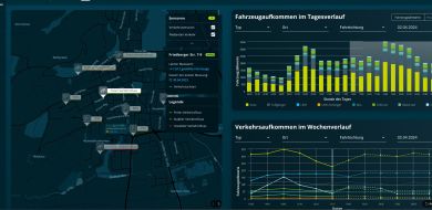
Visualization of information is the basis for the benefits to a city.

A digital city is a very complex subject and affects several areas at once. Here, the possibility to visualize an overall picture is often missing.

[ui!] supports the possibility of identifying the real potential of a Smart City in an urban overview and communicating it to the citizens. 

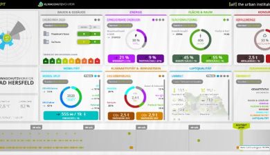
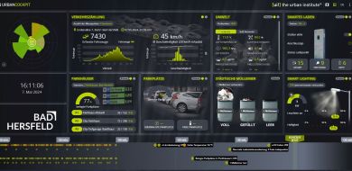
Various [ui!] COCKPITS with different and individually compiled urban data are available.

Here is an example: https://badhersfeld.urbanpulse.de/

[ui!] Festival COCKPIT

With the [ui!] Festival COCKPIT, which was especially developed for large events, important data such as traffic volume and speed, weather data, parking lot occupancy, visitors, temperature and environmental data, towing operations and much more can be displayed in real-time at a control center.

This gives the responsible people an up-to-date overview at any time and that way they can intervene if necessary.

ENVIRONMENTAL SENSORS & INTELLIGENT
MULTIFUNCTIONAL STREET LIGHTING

Street lighting
With more than 20 years of experience, we cover all issues related to street lighting. From simple LED lights, to sensor-based controls and street lighting as a central IoT infrastructure.
Security
Intelligent, situation-oriented systems for increasing public safety with integrated solutions such as emergency call modules, CCTV, audio and image analysis.
Environment and weather
Recording of environmental and weather data according to individual requirements such as: temperature, noise, Co2, ozone, NOX and particulate matter, as well as the determination of the Air Quality Index.
At one glance
Visualization of all collected data on a unique dashboard like the [ui!] COCKPIT.
Usage of calibrated sensors
High quality of the collected data by using professional and calibrated sensors.
Traffic and parking
Real-time analysis of traffic volumes and the utilization of parking areas of any kind, adapted to the existing infrastructure and situation on site.
Transparent data management
The collected data always remains the property of the customer. You decide on the form and scope of use.
Compliance with standards
Compliance with the standards for imHLa according to DIN SPEC 91347.

Would you like to learn more about our solutions?

We are also available for demonstrations at our branches in Berlin, Darmstadt, München, Walldorf oder Chemnitz.

SUSTAINABLE MOBILITY & TRAFFIC OPTIMIZATION

M2Life

... in progress ...

Real-time traffic information
The [ui!] TRAFFIC APP shows the current traffic situation by means of information provided on the basis of data from an urban traffic control computer. Thus real data is displayed in real-time for the user. Here is an example from Darmstadt:
Traffic light phase prediction as a component of traffic optimization

The analysis and prediction of the switching-commands of traffic lights in real-time, provide new types of information, which, via suitable assistance functions, enable "connected" vehicles to make significantly improved journeys through the city's road network. 
Drivers who do not yet have a vehicle with appropriate assistance functions, receive recommendations for optimal driving behavior via the app [ui!] ECOMAT, which they can install on their smartphone. Further information:

Smart travel with artificial intelligence

Development of a nationwide, intermodal travel option - in order to be able to travel with one ticket and a one-time payment process. This will take into account the various regional and national mobility providers, such as rental bicycles, rental scooters, car-sharing, local transport and even rail or air travel. Further information:

Mobility controllers for disabled people
Digital support for the implementation of an accompanying service in public transport.

M2LIFE - Mobility for Living

M2LIFE

We would like to take up your initial thoughts on a mobility concept in order to build on them with our [ui!] M2LIFE mobility offer to cover your needs and help the citizens of your city, community, district or region to achieve the mobility they want for their lives.

For this reason we have divided our [ui!] M2LIFE offer into three different areas:

[ui!] M2CONSULT:
Together with you, we create a current status of mobility options, look for optimization potentials and create a mobility concept tailored to your needs.

[ui!] M2PROJECT:
After the goals have been set, we support and accompany you with our many years of project experience from the initial application to the successful implementation of the set mobility goals.

[ui!] M2PRODUCTS:
According to your mobility requirements, different products of our M2LIFE product suite can help to achieve the goals efficiently and successfully. This ranges from individual mobility to the optimization of fleets through electric vehicles and correspondingly necessary charging infrastructure.

M2CONSULT

In the beginning is the vision

For many years, we have been advising cities, communities, counties and regions in their efforts to define and achieve set goals. We use this wealth of experience for your needs as well.
We support you from the initial idea, through the internal implementation, to the transparent explanation and implementation of the targeted goals, in cooperation with your citizens.
Our analysis method is individually tailored to your needs and can address a wide range of mobility topics:

• Trainings / Conferences / BlueRoom Methodology
With our own BlueRoom methodology, developed specifically for local authority needs, a large number of different interest groups and thus opinions can be taken into account. The challenges ahead can then be tackled jointly and in a goal-oriented manner.

• Fleet Analysis
We analyze your fleet and offer you various sustainable mobility alternatives with electric vehicles at manageable costs.

• Subsidy Consulting
Our specialists analyze the various application options together with you and provide support in the application process.

• Webinars Offered
Specially created webinars can be used in dialog with citizens to clarify the desired goals and the measures required to achieve them.

M2PROJECT

Project success through experience

After you have successfully developed a mobility concept, this then needs to be put into practice in a project. Depending on the complexity of the concept and the required solutions and products, this is very extensive and time-consuming. An administration is usually overwhelmed here if this is intended to be managed in addition to the daily requirements.

[ui!] M2PROJECT supports your community in the entire project management from the preparation of the application to the final implementation. Our experienced and competent specialists will work out a project plan together with you, which will be supervised and implemented by us accordingly.

• Combination of different mobility solutions
• Project management & support
• Development of networked mobility concepts
• Cooperation with public utilities and energy suppliers
• Mobility hub development
• Implementation of corporate mobility management solutions
• Development of operational mobility solutions

• What should your project look like?

M2DATA

Added value through data usage

Leveraging the analytics capabilities developed within [ui!] UrbanPulse, we have developed [ui!] M2Data specifically for our mobility products and solutions. It is the basis for all products and solutions of the [ui!] M2LIFE product suite as well as the Smart Mobility Platform.

Our [ui!] Mobility Analytics Process:

• Supports travelers on their way to their destination with appropriately necessary information about the multimodal use of different transportation options

• Informs about the condition of the rented electric vehicles and can book and pay for them

• Shows visually on a map where the next charging possibilities are, how to reserve them and pay accordingly and

• Who can support mobility-impaired persons on their way currently as a guide

All data required for this purpose is received by [ui!] M2Data from various sources - vehicle telematics, booking systems, traffic control, environmental data, floating car data (FCD) - both offline or batch data, as well as online or real-time data, in a DSVGO-compliant manner. After the migration to GAIA-X/IDS, the data is protected and data sovereignty is ensured.

M2SHARE

Save by sharing

Often it appears that the use of electric vehicles in fleets is considered unprofitable, which is a misconception. Here, [ui!] M2Share offers an alternative to the use of fleet vehicles with combustion engines by enabling multiple vehicle users to purchase electric vehicles at an adequate cost. With the support of the mobility platform, these shared electric vehicles, e-bikes, e-scooters and similar means of transportation, can be used for corporate car sharing (business and private trips), as well as for public car sharing. In this way, the [ui!] M2Share software and services package represents an ideal end-to-end solution for fleet and mobility managers. The software is a complete shared vehicle management system for the operator or administrator, but also includes a user app. The user app allows booking (including modification and cancellation), locking and unlocking the vehicle, documentation and reporting damage.

The admin backend enables the management of users, locations, vehicles and a variety of fleet management functions. For example, vehicles can be booked as "maintenance" and are then automatically not available for regular booking.

The vehicle telematics access organizes the monitoring of vehicle location and EV charging status as well as other status displays. Separation of business and private trips for billing purposes is supported for professional/commercial fleets. While basic reporting and visualization functions are available, access to the raw data via API for deeper data exploration (advanced analysis and visualization) is possible with our product [ui!] M2Data. Via a standard interface, [ui!] M2Share can be connected to the Smart Mobility Platform as a shared mobility provider.

M2CHARGE

Refuel while you sleep

It's a long way to go, but more and more vehicle owners are deciding to buy an electric vehicle. Closely related to this is the possibility of charging the vehicle's batteries overnight at home for the sake of time and cost. However, some vehicle owners are faced with the problem of not having their own parking space and therefore not having their own charging facility. Our "Park and Charge" solution [ui!] M2CHARGE is designed to provide support here.

Why not provide public and private charging infrastructure (e.g. in supermarket parking lots or at public facilities) at night for residents and during the day for ad hoc users. One of the key features of [ui!] M2CHARGE is the ability to reserve such a charging spot. Optionally, this functionality could also be used to reserve a parking space. In addition to booking and billing functions, this solution also includes additional functions such as V2G (vehicle-to-grid), smart charging and dynamic pricing.

[ui!] M2Charge is a service that has emerged from the realization that sustainable electric mobility solutions must be closely linked to the charging infrastructure. In addition, charging facilities for electric vehicles are also parking spaces. For this reason in many cases the management of the parking spaces is also linked to the management of the chargers at these parking spaces.

Our [ui!] M2Charge offer includes:

• Offer and handle Park & Charge opportunities
• Develop and implement charging infrastructure projects
• Leasing of charging infrastructure
• Operation and billing
• Data analytics for determining the location of charging infrastructure

M2CARE

Stay Mobile

Mobility decreases with age, but some appointments outside the home are still necessary. Whether it's a doctor's appointment or other necessary errands, mobility is required in every phase of life.

In order to offer support to people with limited mobility, our [ui!] M2Care uses a mobility solution specially developed for this group of people seeking support. By means of a simple app, we bring the targeted group of people together with mobility guides to enable them to travel by bus and train, which is otherwise no longer possible on their own.

This solution is particularly appealing to people living in rural areas, who can use public transport again and thus give seniors and people with disabilities back a bit of independence.

To request a mobility guide, all you need to do is call or use the app, which then directly plans pick-up and return transport and informs the mobility guide who can be optimally deployed in the vicinity. The trained mobility guides are usually full-time employees, volunteers or spontaneous helpers.

[ui!] M2Care has been currently adapted specifically for the COVID-19 situation, to help vulnerable populations who cannot leave their homes by other means. In fact, it is a solution relevant to many crisis situations where daily mobility patterns need to be changed.

M2MAAS

Mobility on demand

Traveling can be very stressful. In particular, booking different transport options and billing usually requires several apps and time-consuming steps on the smartphone. [ui!] M2MAAS is designed to remedy this and make traveling easier.

The mobility platform used here works according to the eMaaS principle - electric mobility on demand. This multimodal mobility approach integrates several transport operators and mobility providers as well as additional external systems (such as parking, e-vehicle charging options, use of other sustainable forms of mobility, such as e-bikes or e-scooters).

[ui!] M2MAAS makes planning and booking your trip simple and straightforward. Using AI analyses, the app quickly finds out which travel option you prefer in which situation. For example, there is the possibility that you need to get to another place quickly and prefer to use the train here. The program then independently selects the most suitable travel option and informs you on the way if a problem arises. In case of problems due to delays, the program may suggest you rent an electric vehicle at the next opportunity and use it to cover the remaining distance. This is just one of many other imaginable mobility options that would be offered to you by [ui!] M2MAAS.

The special feature of the solution is the possibility of easy payment. Here we build on proven solutions and products from third-party providers, such as SAP and other well-known operators and providers of mobility solutions.

Traveling this way could save you your own vehicle and you could make an important contribution to the improvement of the environment.

ENERGY MANAGEMENT FOR QUARTERS

Smart City Project Sinfonia

Together with international partners, innovative energy solutions are being developed which serve as a model for the European cities of tomorrow.

Sinfonia is the acronym for "Smart INitiative of cities Fully cOmmitted to iNvest In Advanced large-scaled energy solutions."

The focus is on the energetic renovation of buildings, the expansion of the district heating network and the increased use of regional and renewable energy sources.

The project is directly aimed at the scaleability and transferability of the solutions implemented in pilot districts. At the core is the demonstration of technical measures and a great proximity to applications.

With the [ui!] COCKPIT, residents have access to all the digital information available about their apartment. The graphic visualization helps you to understand what is going on in your apartment. A concrete example are parameters, such as room temperature and humidity, which provide an indication for the prevention of mold. Residents can thus react to these indicators at an early stage and instead of when mold is already visible.

Smart Home
The reading of individual consumption data of your own household on your tablets. For this purpose, appropriate sensors are installed and tablets with necessary software are provided.

You have further questions?

Here you may already find some answers to questions, if not - please contact us, we are always available for your concerns.

Questions & Answers

General

Who owns the data?
Data sovereignty belongs to the city or region, which decides which data is passed on to which party of interest, free of charge or for a fee.
Open Urban Platform = Open3

Open Source, Open API & Open Platform Standard.

The open standard of the Open Urban Data Platform supports numerous suppliers of sensor manufacturers of different kinds to collect their data centrally on one platform - to process them and then make them available for further use. The connectors required here can be created by customers themselves free of charge or provided for a small fee by [ui!].

Open Standard = Open Source = Free of charge?
Although there are free open source solutions, which have to be adapted by IT experts in a very time-consuming process, the software is not free of charge.
These costs should not be neglected.
Can our city afford this?
By passing on certain data to third parties, funds can be raised which will pay back the investment in the shortest possible time.

Solutions

How does the [ui!] UrbanPulse work?
The [ui!] UrbanPulse data platform uses existing sensor data, for example from traffic lights, intelligent lighting, parking systems and much more. The data is collected, processed, analysed and prepared for further use by means of connectors. This can be a visualisation by means of [ui!] COCKPIT for the transparency of urban data use towards the citizens as well as. For example, as an annotated road map with traffic information via a web server. In real time - twice as fast as conventional solutions and without a complicated integration process.
What about data security?
Only non-personalized data is collected in the [ui!] UrbanPulse and securely stored on European servers.
Who receives the source code?
The source code belongs to your city or region. In the event that we no longer support you, you will own the source code.

[ui!] Group

How long has [ui!] been around?
[ui!] was founded in 2012 to support cities in their efforts to jointly develop innovative concepts and solutions in the sense of a Smart City and to use them in a meaningful way.
What does [ui!] stand for?

[ui!] stands for innovation - quality - safety - experience - trust. The term [ui!] is an abbreviation for [ui!] Urban Software Institute.

Where can I find [ui]?
The [ui!] Group has five locations in Germany in Berlin, Chemnitz, Darmstadt, Wiesloch and Munich. In addition to the German branches and international subsidiaries in Brisbane (Australia/New Zealand), Budapest (Hungary), Oxford (UK) and New York (USA), there is also the [ui!] Urban Software Institute, the [ui!] Urban Lighting Innovations and the [ui!] Urben Mobility Innovations.
Can I also join the [ui!] TEAM?
Of course - we are looking forward to all applications from people who enjoy working with innovative products and solutions and need their freedom. You can find our current open positions under Jobs.

Would you like to learn more
about our solutions?

Brief2 This email address is being protected from spambots. You need JavaScript enabled to view it.